
Can AI Create a 3D Landscape Model From My Drone?
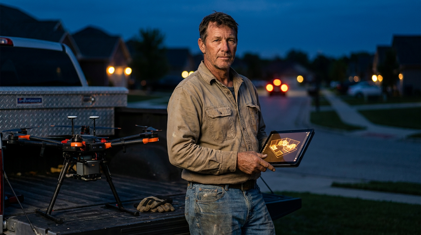
Yes, AI can create a 3D model of a landscape from drone footage using a process called photogrammetry. Software stitches together hundreds of overlapping photos your drone takes, building a detailed and measurable digital twin of the job site. This gives you accurate data for planning, quoting, and client presentations.
Can AI Turn My Drone Footage Into a 3D Landscape Model?
You see the ads. A slick 3D model of a backyard, perfect for showing a client exactly where the new patio and fire pit will go. It looks expensive and complicated. But what if you could make one yourself, using the drone you already own? Good news: you can.
Using AI to turn your drone footage into a workable 3D model is no longer science fiction. It's a real tool that landscaping pros are using to win bigger jobs, reduce errors, and save time. It’s called photogrammetry, and AI has made it faster and easier than ever.
This isn't about creating a cartoon. It's about building a digital copy of your job site that you can measure, analyze, and use to plan your work with incredible accuracy. Let's get into how it's done.
How It Works: The Magic of Photogrammetry
Photogrammetry is the core technology here. The basic idea is simple: take a lot of overlapping pictures of something from different angles, and use software to stitch them together into a 3D model.
Think of it like your own two eyes. Each eye sees a slightly different image, and your brain combines them to understand depth. Photogrammetry does the same thing, but with hundreds or thousands of photos.
Where does AI come in? AI supercharges the process. It helps the software:
- Identify Key Points: AI algorithms are great at finding the same rock, corner of a house, or plant in dozens of different photos.
- Calculate Positions: It uses that data to figure out exactly where the camera was for each shot.
- Build the Mesh: It then connects all those points to create a 3D surface, or "mesh," and drapes the photo textures over it.
- Clean Up the Data: AI can automatically filter out noise, like birds flying through a shot or lens flare, making the final model cleaner.
Before AI, this was a slow, manual process. Now, you can upload your photos and get a model back in hours, not days.
What You Need to Get Started
Getting into 3D modeling isn't free, but you might already have the most expensive piece of gear.
- A Decent Drone: You don't need a top-of-the-line Hollywood drone. A mid-range drone like a DJI Mavic or Autel EVO works great. The key is a good camera (at least 20 megapixels is a solid start) and the ability to fly automated flight paths.
- Photogrammetry Software: This is where the magic happens. You upload your drone images to a cloud-based platform, and it does the heavy lifting. Popular options for the trades include:
- DroneDeploy: Very user-friendly, great for automated flights and analysis.
- Pix4D: A powerful, professional-grade suite of tools with a steeper learning curve.
- RealityCapture: Known for being incredibly fast and detailed.
- Agisoft Metashape: A solid desktop option that gives you a lot of control.
- A Tablet or Smartphone: You'll need this to run the flight planning app that controls your drone.
Most of these software platforms are subscription-based, often charging per month or per project. It's a business expense, so weigh the cost against the time you'll save on manual measurements and the impact on your sales.
The Step-by-Step Process
Here’s a simple rundown of a typical workflow, from site arrival to finished model.
Plan Your Flight: Don't just free-fly it. Use an app like DroneDeploy to automate the flight. You'll draw a box around the property on a map. The app then creates a perfect grid pattern—we call this a "lawnmower" path—for the drone to fly. Set your altitude (usually 100-200 feet) and your image overlap (75-80% is standard).
Fly and Capture: Launch the drone. It will fly the mission automatically, taking hundreds of pictures as it goes. For extra detail on vertical surfaces like the house, you can add a few manual flights from a lower, 45-degree angle (these are called oblique shots).
Upload and Process: Transfer the images from your drone's SD card to your computer. Then, upload the entire folder to your chosen photogrammetry software. The AI gets to work, which can take a few hours depending on the number of images and the size of the site.
Use Your Model: Once processing is done, you get an email. You can now view your 3D model in a web browser. You can pan, zoom, and tilt it. More importantly, you can use built-in tools to measure distances, areas, and even volumes for mulch or soil. You can export the model to use in other design software or just take screenshots for your proposal.
Putting Your 3D Model to Work
A 3D model is more than just a cool visual. It's a powerful business tool.
- Win More Bids: Instead of a flat drawing, show your client a 3D model of their own property with your design overlaid. Let them see the new retaining wall from their kitchen window. This helps them visualize the final product and builds confidence.
- Nail Your Estimates: Stop wrestling with a tape measure on slopes. Measure distances, square footage of turf, or cubic yards of fill directly on the model. This leads to more accurate material quotes and protects your profit margin.
- Better Site Analysis: Spot problems before they happen. Use elevation maps generated by the software to see how water will drain across the property. Check sunlight patterns to make sure you're putting the right plants in the right places.
- Track Progress: For large, multi-stage projects, fly the site every week. The models create a visual record of your progress, which is great for client updates and your own records.
Prompts to Get You Started
Once you have a model, you can use AI assistants to help you communicate its value. Use these prompts to get started.
I've created a 3D model of a client's property using drone photogrammetry. The client wants a new 15'x20' paver patio, a 10-foot long seating wall, and three new maple trees. Based on this model, write a short, confident script I can use during a presentation. Explain how the model helps us plan the project accurately, focusing on proper drainage away from the house and the exact placement of the trees for afternoon shade.
Analyze the data from a 3D landscape model. The model includes topographic information showing elevation. The highest point is in the back right corner of the yard at 105 feet, and the lowest point is near the house's foundation in the front left at 98 feet. Identify potential drainage problem areas and suggest two solutions, such as installing a French drain or creating a dry creek bed, and explain where they should be placed based on the elevation data.
The Downsides: What to Watch Out For
This tech is powerful, but it's not a magic button. Be aware of the challenges.
- Cost: Software subscriptions can run from $100 to over $500 a month for professional-tier plans. You have to be sure you'll use it enough to justify the price.
- Processing Power: While most processing is done in the cloud, viewing and manipulating large models can be tough on older computers.
- Accuracy: The models are very accurate, but not perfect. Dense trees can create holes or weird textures in the model because the camera can't see the ground beneath them. Shiny surfaces like windows or water can also cause problems.
- Regulations: You're flying a drone for business, which means you need to have your FAA Part 107 license. It's a straightforward test, but it's not optional.
The learning curve is real, but it's getting shorter every year. Start with a small, simple project like your own backyard to get the hang of it. After a few flights, the process becomes second nature.
For the modern landscaper, using AI to build 3D models is a game-changer. It sets you apart from the competition and makes your entire operation more efficient, from the initial bid to the final walkthrough.
Frequently asked questions
37 copy-paste prompts that save tradespeople 5+ hours a week. Plus one short email every Friday — no fluff.
More for landscaping
AI for Landscaping Business Owners: Real ROI
AI for Landscaping Business Owners comes down to using AI to do the slow stuff — quoting, paperwork, marketing, and customer follow-up — so you can stay on
ChatGPT Prompts for Lawn Care Business (20 Tested)
ChatGPT Prompts for Lawn Care Business (20 Tested) comes down to using AI to do the slow stuff — quoting, paperwork, marketing, and customer follow-up — so