
Fire Watch: AI for California Defensible Space
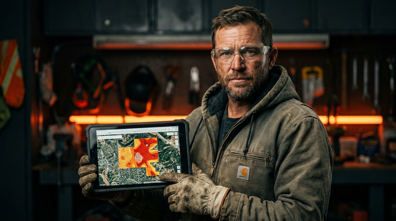
AI for wildfire defensible space in California helps landscapers by analyzing properties for fire risk. Tools use satellite images and local data to map vegetation, identify hazards, and create clearing plans that meet CAL FIRE standards. This makes your work faster, more accurate, and easier to explain to clients.
California is getting hotter and drier. For landscapers, that means more than just dealing with drought-tolerant plants. It means being on the front line of wildfire defense. Creating 'defensible space' around homes isn't just a good idea; it's the law in many areas. It's also a growing business opportunity for pros who know their stuff.
Traditionally, this work meant walking the property, taking notes, and using your best judgment. That still matters. But now, you have a new tool in your belt: Artificial Intelligence. AI can help you work smarter, faster, and give your clients a better understanding of what needs to be done to protect their homes.
What is Defensible Space, Anyway?
Before we get into the tech, let's get the basics straight. CAL FIRE, the state's fire agency, has clear rules. They break down the 100 feet around a home into three main zones. Your job is to manage the fuel—the grass, trees, and shrubs—in each zone.
Zone 0: The Ember-Resistant Zone (0-5 feet). This is the most critical area. The goal here is zero fuel. That means no flammable plants, no mulch, no woodpiles. Use hardscaping like gravel, concrete, or pavers. This zone is all about stopping embers from igniting the house itself.
Zone 1: The Lean, Clean, and Green Zone (5-30 feet). Here, you need to thin out vegetation. Remove dead plants and tree branches. Keep grass cut to a maximum of four inches. Trees should be spaced out, with at least 10 feet between canopies.
Zone 2: The Reduced Fuel Zone (30-100 feet). The goal here is to slow the fire down. You don't have to clear everything. Instead, you create breaks in the vegetation. Remove lower tree limbs, cut grass down, and get rid of fallen leaves and needles.
Knowing these zones is the foundation of your work. AI is the tool that helps you build the plan.
Where AI Fits in Your Workflow
AI isn't some robot that comes out and does the clearing for you. It's software that helps with the thinking part of the job. It’s a digital assistant that can process a ton of information in seconds.
Site Assessment and Risk Analysis
Instead of just eyeballing a property, AI can give you a bird's-eye view with powerful data behind it. Using satellite imagery and GIS (Geographic Information System) data, AI platforms can:
- Map Vegetation Density: Instantly see where the fuel load is heaviest on a property and the surrounding area.
- Identify Topography Risks: Analyze slopes, which can affect how quickly a fire spreads. A fire moves much faster uphill.
- Model Ember Spread: Some advanced tools can even simulate how embers from a potential fire might travel toward a structure.
This gives you a data-driven starting point. You can walk onto a jobsite already knowing the three biggest problem areas, making your on-the-ground survey much more efficient.
Planning and Design
Once you know the risks, you need a plan. This is where you can use AI chatbots like ChatGPT or Gemini to speed things up. You can feed them information about the property, and they can help you draft a checklist or a report based on CAL FIRE guidelines.
Act as a California-based landscaping consultant specializing in wildfire-defensible space. I am assessing a 1-acre property in zip code 90210. The property has a main house, a steep grassy slope on the north side, and is surrounded by dense chaparral. Based on CAL FIRE guidelines, generate a work plan broken down by Zone 0, Zone 1, and Zone 2. For each zone, list 3-5 specific, actionable tasks for my crew to complete. Emphasize tasks related to the slope and surrounding chaparral.
AI can also help with one of the trickiest parts of the job: plant selection. You need plants that are not only fire-resistant but also appropriate for the local climate and the client's aesthetic tastes.
Client Communication and Quoting
Homeowners don't always understand why you need to remove a beloved old shrub or trim back a tree. It can feel aggressive. AI helps you show, not just tell.
You can use AI to generate simple reports with visuals. A satellite map with a red overlay on high-risk vegetation is much more powerful than just talking about 'fuel load'. It makes the threat real.
This clarity helps you sell the job and justifies the cost. When a client sees a clear, professional plan based on real data, they have more confidence in your work. It can make the quoting process smoother because the value is obvious.
Prompts to Get You Started
Here are a couple more prompts you can copy and paste today to see how this works. The key is to be specific and give the AI a clear role to play.
I need a list of fire-resistant plants for a landscaping project in Marin County, California. The client wants native, drought-tolerant plants that will look good year-round. Provide a list of 5 ground covers, 5 shrubs (under 6 feet tall), and 3 small trees (under 25 feet tall) that are suitable for Zone 1. For each plant, include its common name, scientific name, and a brief note on its fire-resistant properties.
This next prompt helps you with the business side of things. It turns your technical plan into a simple, reassuring email for your client.
Write a brief email to a new client, Mrs. Smith. Explain the 3-zone defensible space plan we created for her property. Use simple, non-technical language. Focus on the goal of protecting her home and family. Keep the tone professional, confident, and reassuring. Mention that the work is based on official CAL FIRE safety standards. End by telling her we are ready to schedule the work.
The Limits of AI
AI is a powerful tool, but it's not a magic wand. You are still the expert in the field. Here’s what to keep in mind:
- Ground Truth is King: An AI can analyze a satellite photo, but it can't see the dead pine needles piled up under a deck. It can't feel how dry a patch of grass is. You must always walk the property and use your own senses and experience.
- Data Can Be Old: Satellite images might be months or even years old. A lot can change in that time. New structures could be built, or vegetation could grow back.
- Regulations Vary: CAL FIRE provides the baseline, but local cities and counties may have stricter rules. Always verify your plans against the latest local ordinances. AI might not have the most current local information.
Think of AI as your new apprentice. It can do a lot of the prep work and research, but you, the master craftsman, make the final call.
By adding AI to your process, you’re not just clearing brush. You’re offering a sophisticated, data-backed service that makes properties safer. You’re showing clients that you are a modern professional who uses the best tools available to get the job done right. In a state where wildfire is a constant threat, that’s a service every homeowner needs.
Frequently asked questions
37 copy-paste prompts that save tradespeople 5+ hours a week. Plus one short email every Friday — no fluff.
More for landscaping
AI for Landscaping Business Owners: Real ROI
AI for Landscaping Business Owners comes down to using AI to do the slow stuff — quoting, paperwork, marketing, and customer follow-up — so you can stay on
ChatGPT Prompts for Lawn Care Business (20 Tested)
ChatGPT Prompts for Lawn Care Business (20 Tested) comes down to using AI to do the slow stuff — quoting, paperwork, marketing, and customer follow-up — so